File:Timesbeachshoal-stlco-aerial.png
Jump to navigation
Jump to search


Size of this preview: 800 × 330 pixels. Other resolution: 1,335 × 551 pixels.
Original file (1,335 × 551 pixels, file size: 1.21 MB, MIME type: image/png)
Summary[edit | edit source]
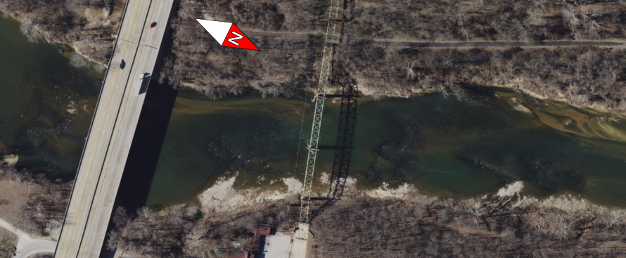
Aerial photography from St. Louis County Assessor. Flow is left to right. I44 is visible on the far left.
File history
Click on a date/time to view the file as it appeared at that time.
| Date/Time | Dimensions | User | Comment | |
|---|---|---|---|---|
| current | 03:14, 1 January 2026 | 1,335 × 551 (1.21 MB) | Rootwad (talk | contribs) | more pixels! |
| 03:12, 1 January 2026 | 890 × 367 (576 KB) | Rootwad (talk | contribs) | added compass rose | |
| 21:06, 31 December 2025 | 1,461 × 952 (3.17 MB) | Rootwad (talk | contribs) | Aerial photography from St. Louis County Assessor. Flow is left to right. I44 is visible on the far left. |
You cannot overwrite this file.
File usage
The following page uses this file: