File:Plum Ford Road property lines.png
Jump to navigation
Jump to search


Size of this preview: 800 × 393 pixels. Other resolution: 1,870 × 918 pixels.
Original file (1,870 × 918 pixels, file size: 3.93 MB, MIME type: image/png)
Summary[edit | edit source]
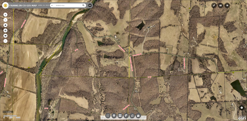
Screenshot from Franklin County Assessors Property Viewer showing public and private property lines in the area of Plum Ford and Meramec River
File history
Click on a date/time to view the file as it appeared at that time.
| Date/Time | Dimensions | User | Comment | |
|---|---|---|---|---|
| current | 17:17, 16 December 2025 | 1,870 × 918 (3.93 MB) | Rootwad (talk | contribs) | Screenshot from Franklin County Assessors Property Viewer showing public and private property lines in the area of Plum Ford and Meramec River |
You cannot overwrite this file.
File usage
The following page uses this file: